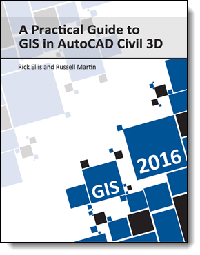
After trying many Civil 3D textbooks and training materials in my classes I have found A Practical Guide to AutoCAD Civil 3D to be comprehensive and detailed yet not overwhelming. This book is organized the way a professional would develop a civil engineering project giving clear and concise steps, exercises, and guides along the way to quick proficiency in using AutoCAD Civil 3D. The best on the market! I continue to recommend this guide to my colleagues.
Danial L. Perry, MBA, PLS
Utah Valley University
Rick Ellis is one of the leading authorities on Civil Engineering & Surveying software in the United States and the author of the Practical Guide series. He lectures and teaches seminars across the country. I have attended his seminars. The textbooks Rick Ellis has written have been an exceptional addition to my classroom. They are written with thought and imagination. They are direct and to the point. They are easy for the students to follow yet challenging enough to keep the students interested and using their skills and learning to think through exercises. I would suggest all Civil Engineering and Surveying professors review his books. Once read and reviewed I would venture to say, they will be using them in the classroom.
Robert Vetrano
Springfield Technical Community College
More About The Book
Takes you through a complete project using Autodesk Civil 3D. It is 337 pages long, organized into 9 chapters. Beginning with importing GIS data and survey points, continuing through creating surfaces and parcels, and concluding with road design, grading, and exporting points for staking, it is largely exercise based, proving step-by-step procedures for many common tasks.
One of the most important features in Civil 3D is Styles. Styles control the display, labeling, and in some cases the geometric properties of Civil 3D objects. This book exposes you to many different object and label styles as you work through the project, teaching you the concepts within the context of an ordinary workflow.
Since many of you will be transitioning from Land Desktop, many tips are included to make this process easier.
Author
Rick Ellis, president of CADapult Software Solutions, Inc, has worked with and taught Autodesk Civil 3D, along with Map 3D and other Autodesk products since the mid-90s. He is the Author of several critically acclaimed books on Autodesk Civil 3D, AutoCAD Map 3D, Land Desktop and Carlson Software; including the Practical Guide series.
Rick continues to use Autodesk Civil 3D on projects in a production environment, in addition to teaching classes to organizations both large and small around the country, helping them get the most out of their design software investment.
This practical background and approach has made him an award winning speaker at Autodesk University and a sought after instructor by organizations around the world.
Weight
1.5 lbs
Dimensions
9 × 6.5 × 1 in
Features And Benefits Of All CADapult Software Books
Lessons build upon one another using a contiguous dataset, providing consistency
Skills learned through easy-to-follow, step-by-step procedures
Sequential exercises that follow one logical, real-world example project
Flexible datasets allow you to “skip ahead” to a relevant lesson, or use as an on-demand reference guide
Detailed explanations and chapter summaries facilitate learning and retention
Written by instructors with decades of industry and teaching experience
Tested and refined in classrooms with a broad cross-section of students